urban design & planning
With extensive experience in urban design and planning, we offer the following capabilities.
Conceptual site plans and 2D- and 3D-massing studies to explore potential development yield, both in the context of existing zoning and through other options such as redevelopment planning.
Development review for conformance with zoning, and best practices in urban design such as connectivity, human-scaled massing, and creation of inviting public spaces.
Writing of urban design guidelines encompassing site planning, building massing and architecture, parking, landscaping, lighting, and signage, tailored to the site and community characteristics.
Creation of policies from zoning codes to broad vision plans to support inviting and pedestrian-friendly streetscapes, building transparency, human-scale form, and compact but engaging public spaces.
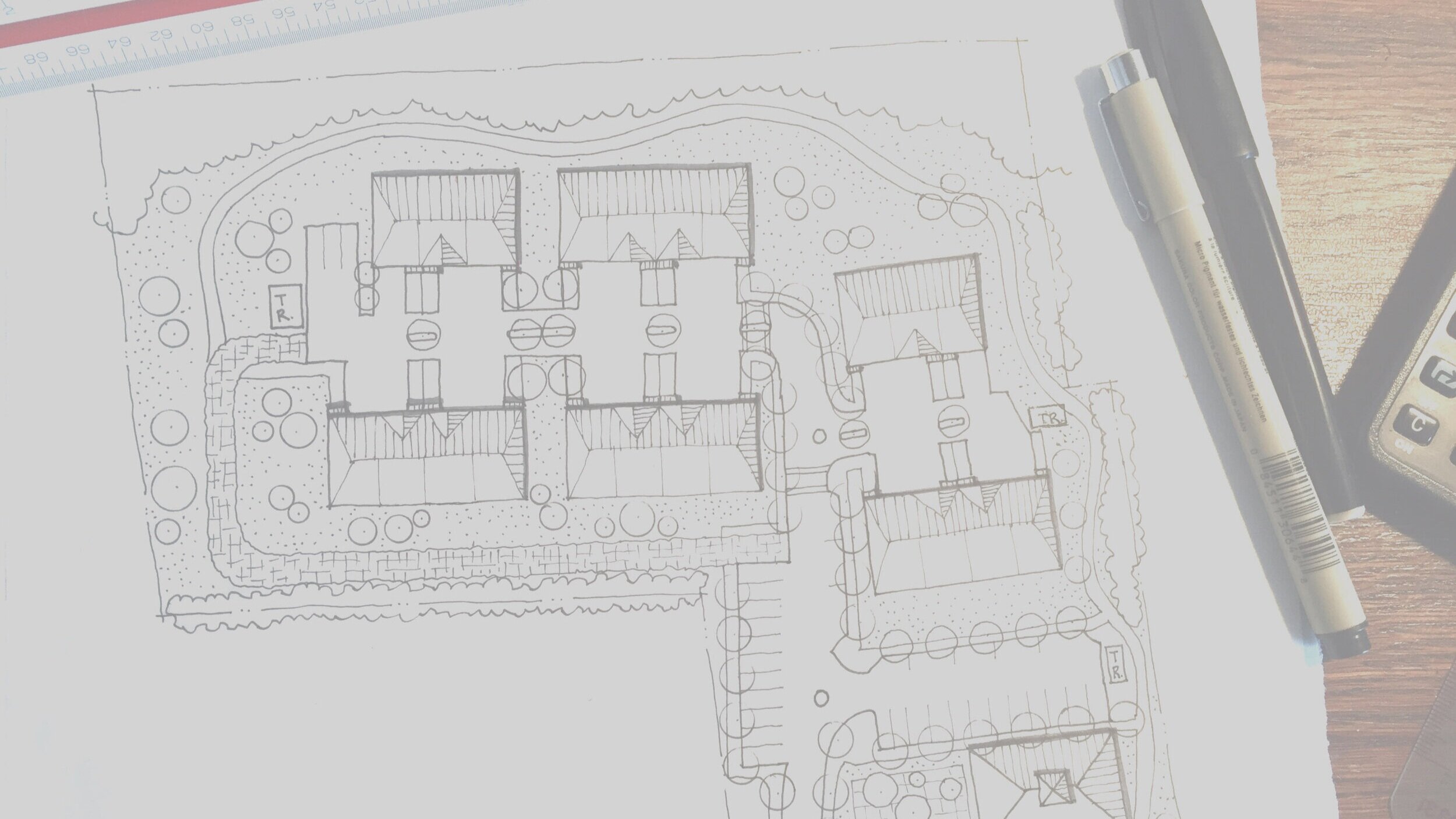
conceptual site plans
Our conceptual site plans for larger project areas begin with an assessment of site characteristics such as grades, vehicular access, viewsheds, natural features, and adjacent land uses. Buildings and streets are oriented to create and frame central open spaces such as pocket parks, plazas, or linear corridors. Where possible, parking is placed away from important public spaces and major pedestrian routes; otherwise, active uses or architectural screening can be used to disguise structured parking that extends to the facade. Site planning experience includes all building types from single family homes to townhouses to stacked flats to multi-family apartments, high-rise towers, mixed-use buildings, offices, retail shopping centers, industrial warehouses, and parking garages. Supplementing the site plans with prototype imagery helps communicate the flavor of buildings and open spaces.

Alley-loaded townhouses facing new and riparian open spaces

Conceptual park design with varied programming to benefit many different potential users.

Conceptual plan and yield study for a retail-entertainment development with a large public plaza / open space, intended to create a “there” for this suburban community.
massing and yield studies
For smaller sites and for more in-depth exploration of higher-intensity building types, yield studies explore how much square footage or units can fit, given assumptions for parking ratios, open space, and allowable building height. A sensitivity analysis tests what could be possible if any of these factors change.

This study of buildout at the maximum FAR was prepared for a neighborhood group concerned with the potential expansion of a hospital within their small-scale residential neighborhood.

A massing study for maximizing residential yield on an urban infill site evaluated the relative merits of higher yield, taller steel buildings versus lower-scale, higher-coverage stick over podium buildings. Floor plans for typical floors were also prepared, showing the unit breakdown and net/gross ratio.
development review
We have reviewed dozens of proposed projects on behalf of numerous municipalities, and have worked directly for developers and their architects and engineers to reshape their projects. Often, modest changes to such elements as building massing, articulation, transparency, location and screening of parking, and footprint can yield large improvements to the project’s relationship to the surrounding streetscape, resulting in a more friendly, human-scaled appearance and improved public spaces.
zoning and design guidelines
We have crafted numerous design guidelines and zoning codes that aim to allow flexibility in development form and style while ensuring that certain goals related to the public realm are met. Standards for site access, building orientation, and open space; and building bulk, transparency, massing and articulation all help to guide development. Treatment of parking, including hiding and screening structured parking and downplaying the visual dominance of surface parking, is always a critical element.
streetscape concepts

Cross-section showing how a main street could be revised to create a comfortable pedestrian environment for visitors, with wider sidewalks, bike lanes, street trees, and narrowed driving lanes. Created as part of a Vision Plan for the downtown.

Streetscape design showing how a wide, fast-moving street could be traffic-calmed with bulb-outs, addition of on-street parking, trees in the parking lane, and infill with new street-facing buildings.
3D renderings

Rendering of potential development and new public plaza space atop a below-grade parking deck next to the Staten Island Ferry. The plaza is at grade with the main street and draws people in and towards the ferry terminal.

Conceptual design of a new office and station canopy at an old gas station that wanted to expand the number of pumps, but was faced with opposition from a residential neighbors.

3D rendering showing a proposed pedestrian street with streetcar line in Yongsan International Business District, Seoul, Korea.